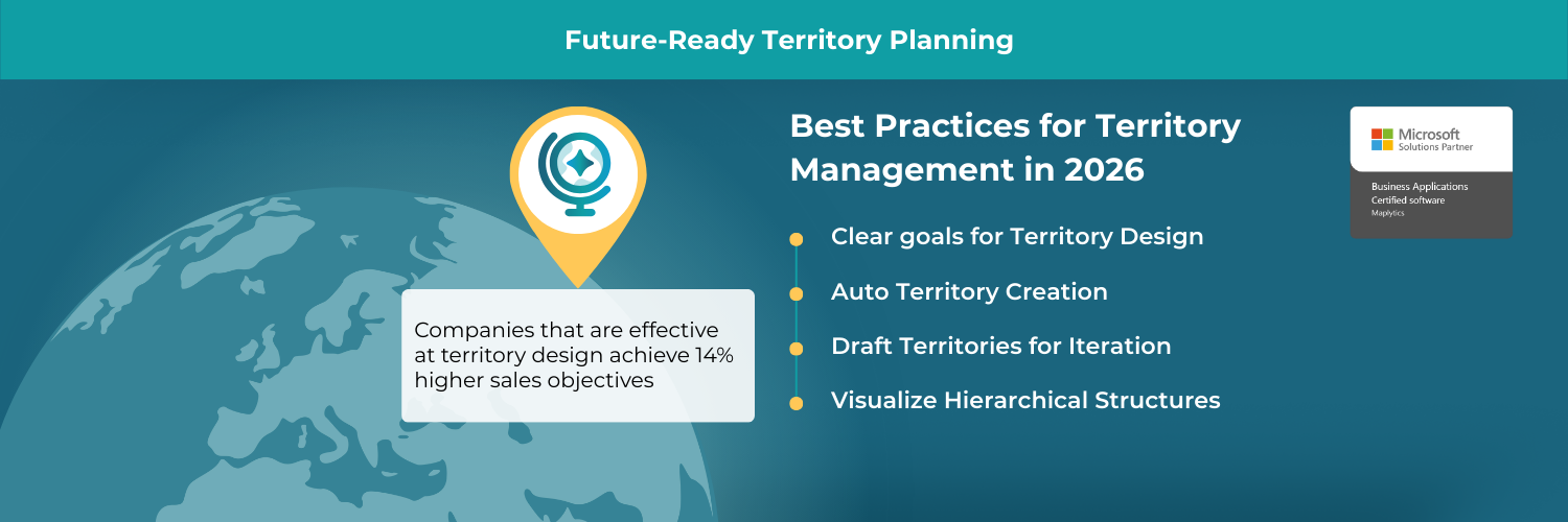
Companies that are effective at territory design achieve 14% higher sales objectives, while poorly designed territories correlate with 15% lower sales performance.
Why Territory Management is Now Strategic?
The moment a company expands into new markets or starts relying more on field teams, one truth becomes clear- ‘geography isn’t just distance, it’s strategy’. How you assign and balance territories can make or break productivity and customer satisfaction.
Poorly designed territories can lead to uneven workload, coverage gaps, overlap, and frustration for sales reps. In 2026, territory planning must go beyond basic zip-code splits. It must be data-driven, dynamic, and responsive to changing business needs. That’s where map-based tools like Maplytics’ Territory Management come into play. They enable leaders to visualize, align, optimize, and rebalance territories with precision within Dynamics 365.
Key Principles of Modern Territory Planning
Before diving into how to use Maplytics, here are some territory-planning principles that every business leader should keep in mind:
- Balance workloads: Equitable distribution prevents burnout and optimizes rep productivity.
- Align with business metrics: Territories should reflect not just geography, but factors like revenue potential, client count, or annual growth.
- Make it visual: Maps help stakeholders clearly see coverage, overlap, and opportunity.
- Plan for flexibility: Markets change, so your territory plan must be adaptable.
- Empower collaboration: Drafting, reviewing, and refining should include cross-functional input from sales, operations, and management.
- Use data wisely: Incorporate customer data, historical sales, and forecasted potential in planning decisions.
These practices help turn territory planning from a one-time exercise into a dynamic, ongoing process, and Maplytics supports all of them in a modern, integrated way.
You can download a 15-day free trial of Maplytics now and experience the tool in your environment! |
What is Maplytics’ Territory Management?
Maplytics brings powerful territory planning into Microsoft Dynamics 365 CRM via its dedicated Territory Management module. Through its map-based interface and intelligent features, Maplytics helps you:
- Create territories manually or automatically using different inputs.
- Upload external geography files, such as shape (.shp, .kml, .geojson) or Excel, to define regions.
- Overlay ESRI’s ArcGIS Feature Layers as well for territory marking
- Balance territories by record count or alignment criteria like revenue.
- Save drafts and rework them before committing them live.
- Visualize hierarchical territories, including parent-child relationships.
- Plot existing territories and their assigned records on the map.
- Use a territory alignment tool to select, align, adjust, or delete region shapes.
These capabilities make territory planning in Maplytics both powerful and highly flexible.
What are the Best Practices for Territory Planning with Maplytics
Here’s how to fully leverage optimized territory management in 2026:
Define Clear Goals for Territory Design
Begin with your business goals-
- Do you want to maximize sales,
- reduce travel time,
- increase efficiency, or
- improve rep balance?
Use those goals to determine your alignment criteria (e.g., revenue, number of accounts).
Use Alignment-Based Auto Territory Creation
With Maplytics, you can automatically generate multiple territories by uploading a shape file or Excel, then choosing alignment criteria, like annual revenue, to evenly distribute your key metrics.
This creates balanced territories in one click and saves hours of manual planning.
Leverage Draft Territories for Iteration
Don’t finalize your territories on the first go. Save your progress as a draft so you can rework, get feedback, and test scenarios. Once you are confident, you can commit those drafts to your CRM as live territories.
This iterative approach ensures your final plan is more thoughtful and aligned with business needs.
Visualize Hierarchical Structures
If your organization requires multi-level territory hierarchies, Maplytics supports hierarchical territory plotting. Parent territories and their child territories can be displayed together, helping managers understand the full structure.
This is particularly helpful for larger organizations or layered sales territories.
Use the Alignment Tool for Precision
Use the Territory Alignment Tool in Maplytics to draw shapes, select multiple regions, and create territories on the fly. This tool lets you precisely define the geographic regions for each territory.
You can also choose to delete or adjust shapes until the alignment feels right.
Assign Managers and Define Ownership
During territory creation, Maplytics allows you to assign a manager to each territory.
This role-based assignment helps maintain ownership, accountability, and clear responsibilities among field or sales leaders.
Monitor and Rebalance Over Time
Planning is continuous. Use Maplytics to plot existing territories and their mapped records.
Analyze how territories perform, and use Territory Management to realign them periodically based on changing account distributions, sales performance, or new business opportunities.
Why do balanced territories matter?
Implementing territory planning with Maplytics offers tangible benefits for modern organizations:
- Better Sales Productivity: Balanced territories mean reps spend more time in high-potential areas and less time traveling or duplicating coverage.
- Reduced Operational Costs: By minimizing overlap and inefficiencies, companies can save on travel, fuel, and admin costs.
- Improved Accountability: Assigning managers to specific territories ensures clarity on who owns which region and how performance will be tracked.
- Data-Driven Decisions: Territory planning becomes part of a visual, map-based workflow, empowering leaders to make smarter, spatially informed decisions.
- Scalable & Flexible: Whether launching a new region or fine-tuning existing landscapes, Maplytics’s auto-creation and alignment tools make it fast and scalable.
Future-Ready Territory Planning
As we look ahead into the next few years, some emerging trends will further shape territory management:
- AI-Driven Optimization: Use machine learning to predict demand, optimize territories dynamically, and reassign accounts based on changing conditions.
- Real-Time Data Integration: Sync territory maps with real-time CRM activity, usage trends, and newly acquired leads to adjust territories on the fly.
- Hybrid Sales Models: Blended territory planning for field and remote sales reps, Maplytics maps can help unify these models with geo-analytics.
- Sustainability Metrics: Incorporating carbon footprint and travel emissions in territory design, optimizing not just for productivity but also for environmental impact.
- Balanced Worklife: Overall, accurate and optimized planning results in a balanced life for all employees.
With Maplytics, your organization can strategically navigate these future trends, creating territories that are not only efficient but also forward-looking.
FAQs: Territory Planning with Maplytics
Q1: Can I create territories automatically with Maplytics?
Yes, Maplytics supports auto-territory creation using shape files or Excel. You can set the number of territories and alignment criteria (e.g., revenue), and Maplytics will generate balanced territories.
Q2: What is the “draft territory” feature?
Draft Territories let you save your work mid-creation. You can pause, review, adjust, and refine territories before saving them permanently in Dynamics 365.
Q3: Can I visualize hierarchical (parent-child) territories?
Absolutely. Maplytics supports hierarchical territories, so you can plot parent and child territories together and view territory relationships on the map.
Q4: How do I assign a manager to a territory?
When creating a new territory (manually or via auto-creation), you can assign a manager to the territory. That manager is responsible for overseeing that region.
Q5: How can I plot existing territories along with their CRM records?
Use the “By Territory” plotting option in Maplytics. You can select “My Territory” or “My Team Territory” to visualize assigned records on the map.
Q6: What is the Alignment Tool in Territory Management?
The Alignment Tool lets users select, multi-select, delete, or realign regions/shapes on the map. It’s a flexible way to define or adjust territories visually.
Q7: Do I need a special role in Dynamics 365 to use Territory Management?
Yes, in Maplytics, you can grant the Maplytics Territory Manager role to users. Only users with that role can create or manage territories.
Q8: Can I change the territory names, colors, or attributes?
Yes, during territory creation, you can set custom names, colors, and assign attributes. For auto-created territories, you can rename them and configure their visual style before committing them.
Leading with Territory Planning in 2026
With Maplytics Territory Management in Dynamics 365, organizations can unify geographic insights, account data, and performance metrics into a mapping-first approach that drives productivity and clarity.
By adopting best practices, like automatic territory creation, hierarchical visualization, alignment-tool workflows, and iterative drafting, businesses will be better equipped to assign, monitor, and optimize their field coverage. If you’re ready to make your territory planning smarter, more rigorous, and data-driven, consider scheduling a demo or starting a free trial of Maplytics for Dynamics 365 today. For details, reach out to us at crm@inogic.com or visit the website to get started.
For more information, visit our Website or Microsoft AppSource. One can hop onto the detailed Blogs, Client Testimonials, Success Stories, Industry Applications, and Video Library for a quick query resolution. Technical docs for the working of Maplytics are also available for reference.
Kindly leave us a review or write about your experience on AppSource or the G2 Website.


