We have been working extensively with Maplytics to make it even more efficient to help our Dynamics 365 CRM / PowerApps customers globally carry out their tasks easily and quickly with increased productivity. In the last release, we had added PCF Controls which provides the geographical insights for CRM data on the CRM page itself. Among these PCF controls, we had also added Detail Map Control as well which helped our users to perform Maplytics features on the map right on the CRM page without needing to switch to another map page. We have enhanced the Detail Map Control with many more Maplytics features. Let’s explore these additions done in this latest release.
PCF Control – Detail Map Control for Dataset
This PCF control can be added to any entity, dataset or dashboard to visualize all the records of the view, sub-grid or dashboard on a map. Users can easily categorize data, perform proximity search, routing and take advantage of many other features within this control. And to make the plotting, routing and visualizing of data more efficient, additional features have been added in this PCF control. Let’s go through all the additional features added and understand them in brief:
Plot multiple datasources
Other than the default view of the selected datasource, users will now be able to select two more datasources and their respective active views (System views, Personal views, Maplytics Dashboards and Marketing Lists) of the selected datasource. This will help the user to visualize three different views on a single map.

Categorization for multiple datasource
Users can now categorize multiple datasources and plot them as color coded pushpins on the map. For each entity selected, user can categorize with one attribute and thus can drill down into the data to get insights for analysis.

Search Options
In this release, users will be able to plot the data in the region of interest on the map with Detail Map Control. They will be able to use the two search options provided which are ‘by Region’ and ‘by Drawing’. With ‘by Region’ user will be able to plot the required region like city, state, country postal code etc. With ‘by Drawing’ user will be able to draw a shape on the map at the required area. Thus, with these options, users will be able to view the records that fall into the selected regions or the shapes drawn on the map.
In the below screenshot, all the account records plotted in Alabama, USA is shown.

The below screenshot shows the account records falling into the drawn shapes.

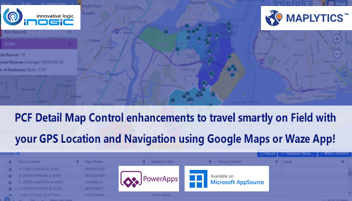
Route options
With this release, users will be able to navigate themselves using Google maps or Waze apps and use the turn by turn directions to reach the destination in time. Users will get further options like selecting the unit for the distance either in Miles or in Kilometers, plot routes with different options to optimize the route and reduce the time, avoid toll & traffics, etc. by clicking on the Options button in the direction card. Users will also be able to send route details in an email and easily clear routes using quick action buttons in the direction card.

Layer menu
While users work with multiple data plotted on map, they will be able to show/hide the required data among the multiple data plotted with this layer menu. With the help of toggle buttons on the Layer menu card, user can decide what is displayed on the map without removing the data from the map.

Current location
While using Maplytics Detail Map Control on Mobile/Tablet, users can now easily plot their current GPS location with the help of the ‘Locate me’ button thereby making it easier to perform proximity search and relate the data plotted on the map in terms of their location.

Security Template
Now with this release, security templates can be applied to Detail Map Control for Dataset as well. Maplytics Admin and System Admin can decide which features an individual user can have access to. If the admins want to restrict access of certain Maplytics actions to any selected user, then they can simply deselect the respective action in the security template and assign the template to the respective user. This way admins can provide selective access of Maplytics actions. With this release the security template assigned to a user will also have effect in the Detail Map Control.
This new release will further boost productivity of Field Sales and Field Service users with increased efficiency of Maplytics features to facilitate users in their analysis and decision making.
Keep checking our Maplytics website and blogs to know more about the updates on the latest release and contact us at crm@inogic.com to discuss your mapping requirements within Dynamics 365 CRM or PowerApps.
Download the preferred solution for a free trial of 15 days from our Website or Microsoft AppSource.


