In our latest release of Maplytics in December 2020, we optimized some of the most celebrated features of Maplytics. With the latest updates, users can perform time-intensive activities in minutes with intelligent automation to make their complicated processes quick and hassle-free. One such feature was the Auto-Create Territories within Territory Management that allowed users to auto-create balanced territories in a matter of seconds. Along with this, we have also introduced the use of Overlay within Territory management. This allows users to use the Overlay feature for analyzing more layers of data while creating territories within Territory management. This data can then be used to make informed business decisions. Let’s understand the use of this feature with a use case.
Jessica is the sales manager in her organization and handles the team of sales reps. She is already using Maplytics to create balanced territories for her sales team. Now that she is doing well in her current territories, she wants to tap into new areas to grow the business even more. She wants to compare the regions her sales team is already working in and the new market regions nearby which have a high potential of giving business. Therefore, she uses Maplytics to understand where she can expand the business even more.
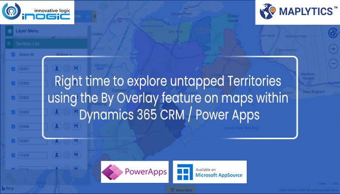
She opens the Territory Management in the Detail Map and selects the ‘By Territory’ option to plot the current territories her team is handling.


She is now able to see a part of the territories that are handled by her team within Staten Island.

To view untapped areas, she uses an Excel file to plot the regions on the map. She chooses the option of Overlay and selects the shape file that she had already saved in the CRM. This file also has the data about the population within the respective areas, so she chooses the ‘Category Attribute’ as Population to categorize and color code the regions. She also chooses Area and Population as a Summary attribute to view these on the hover and click of any region.

Jessica is now able to see the untapped regions along with the territories she has been handling. Due to the categorization, she is able to easily understand which regions have the most population. She is also now able to view more details about the regions by hovering or clicking on the individual regions.

She can now easily select the regions with the highest population and right-click to create territories out of the regions so as to assign these territories to her sales team and consequently grow the business into these new regions.

Similarly, Jessica can even plot her other census data files that have the demographics data about the population within the regions like income, gender, age group, etc. to analyze where the target audience is more which will help her make decisions for creating new territories. Thus, she can use the feature of Overlay to analyze census data on the map along with her existing data in CRM and further plan strategies to expand the business into new regions.
This was just a glimpse into the insight and geo-analytical power of Maplytics that allows organizations to use locational intelligence for making informed decisions. Maplytics also provides various ways to search and analyze data like By Location, By Territory, By Region, etc.
If you would like to unlock such insights for yourself, you are always welcome to start your mapping journey with us by starting your free trial from our website or Microsoft Appsource (make sure to check our Preferred Solution badge). Once you have installed Maplytics, you can start exploring Territory management and many other features to understand new market areas and take the necessary business actions. Similarly, you can also contact us at crm@inogic.com to get a free demo of Maplytics features given by our experts to address any and all concerns or queries you may have.
So until next time –start overlaying your mapping decisions with Maplytics!


