Organizations have a whole team of sales/service field reps and one of the best processes to manage the responsibilities given to the team is using Territory management. Maplytics is one of the leading location app for Dynamics 365 CRM/ Dataverse for Territory management with the ability to create territories automatically as well as based on various regions or drawn shapes. While using territory management, it is also very useful to use the territories in a hierarchical manner. While Dynamics 365 supports the hierarchical territories, using Maplytics one can visualize the multi-level territories created for field reps on the map.
Let us understand how to use hierarchical territories within Maplytics with a use case. Glowvio is an organization that sells Spa and Salon equipment and has opened a new branch in Paris. The Business Development Manager Gabriel has created the territories using Territory management within Maplytics. He has used the option of ‘By region’ to create the territories based on city and Postal code. He has created a territory for Paris city to assign it to the Team leader Andre. Gabriel has also created the territories for the postal codes within Paris city to assign it to the sales executives under the responsibility of Andre that go on the field to meet the Salon/Parlour owners.
While he creates the territories, he also sets Andre and the field reps as the Territory Manager for the respective territories. Once the territories have been created, Gabriel also sets the territory for Paris as the parent territory for all the territories created for the postal codes within Paris for the executives.
So, this way, Andre being the team leader, has been assigned with the responsibility to increase the business in the whole area of Paris city. Along with this, Andre is also responsible for the productivity of the sales executives that have been assigned with the territories of the Postal codes within Paris.
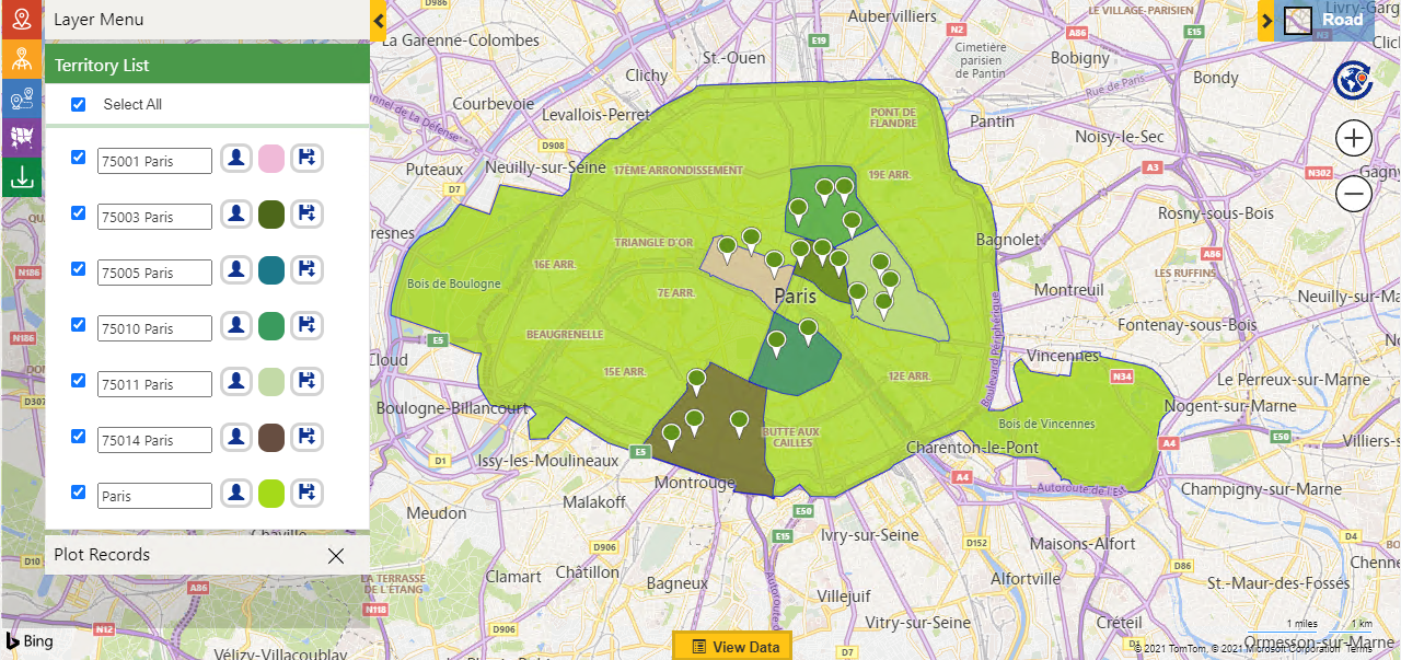
Once Gabriel has created the territories and assigned them to the respective reps and team leads, Andre can easily check the territories that he is responsible for using Maplytics. Gabriel uses the option of ‘By territory’ in Maplytics to plot the territory that he has been assigned i.e., Paris. While he chooses Paris territory to the plot, he is also able to view the child territories of the postal code within Paris that has been assigned to the executives. This is because the territory for Paris has been set as the Parent territory of the territories for the postal codes within Paris.
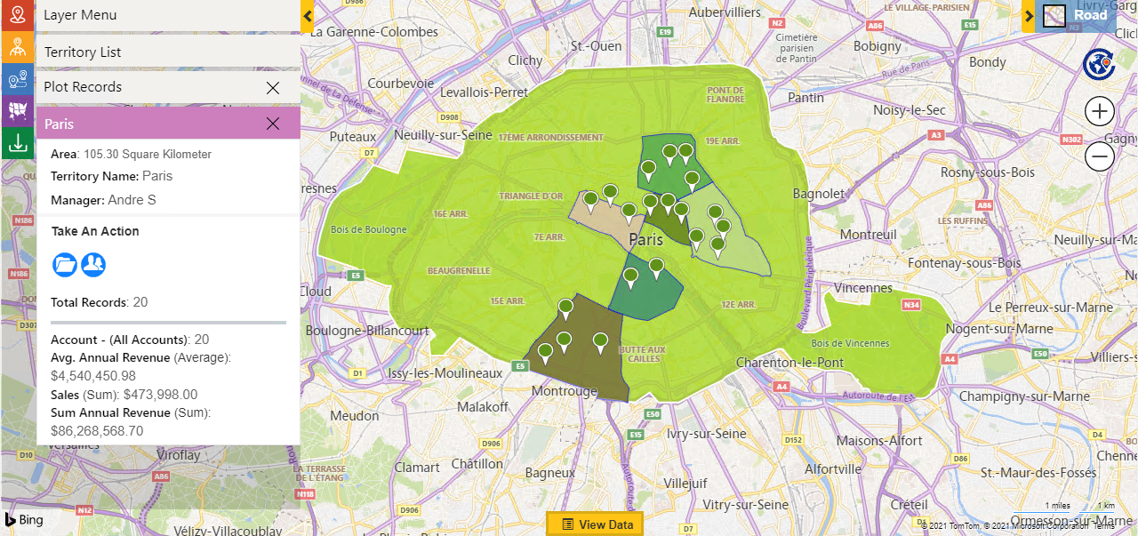
Gabriel can also click on the individual territories to get the summary card that shows the details of the records lying within the territories. Hence, with the visualization of multi-level territories, Gabriel will be able to view how many accounts or leads are being worked on within Paris by his executives and can take further measures to align the effort of the field reps with the fulfillment of the sales targets.
This way a user can view the child territories as well along with the parent territory for which they have been set as territory manager or the member and visualize the multi-level territories to analyze all the regions they are responsible for.
Check out the latest features added in the latest May 2021 release. Start a free trial today to use Maplytics’ latest features for your mapping needs.
Check out our Maplytics Docs to learn more about Maplytics or drop us a mail at crm@inogic.com for a personalized demo.


