It is common knowledge that water consumption in the summers increases without much effort. It goes up by up to 30-40% at the least for humans. Apart from humans, birds and other stray animals roaming around during the peak hours of the heat also need water. Some experts claim, that every year, on average, 60-75% of the birds and stray animals die due to extreme heat or extreme cold, world-over. Humans acclimate themselves to such extreme weather conditions in the comforts of their homes but the homeless birds and strays have no safety measures.
In such situations, the selfless work of local NGOs helps in preserving lives. They often spot such animals in need, treat them, feed them, and protect them until they are healthy enough for adoption. However, the network of the NGOs needs to be extremely strong to witness quick actions. Many stray lives are lost as the help arrives late due to the communication gap. This triggers a thought of empowering the non-profits at their main, central headquarters with technological excellence. This technology could help in spotting areas where emergencies are faced frequently, ways to reach such places in a jiffy, being able to provide medical and other assistance on the go, and more.
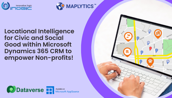
A befitting solution to all these problems could be an all-inclusive package that integrates maps with data records that can be visualized virtually. Maplytics, a popular mapping app within Dynamics 365 CRM sounds like a proper answer to seal this communication gap.
Visualize rescue records over Maps:
Maplytics is a preferred, 5-star rated app on Microsoft AppSource. It harnesses the power of geo-analytics by assimilating CRM Records with Maps. This aids businesses to visualize data over maps find places in the proximity of the records, plot navigating routes to such places, auto-schedule donor visits, manage territories, and so on! Let us see how this amazing package can strengthen the base for non-profits in different situations. Every year, many strays and birds are rescued by NGOs. The central, head office of a non-profit that has a chain of offices throughout the area can update its CRM Records with the locations of such rescues done. The similarities between the areas could be spotted and updated.
Once the spotting areas are in place, the records for qualified vets, animal hospitals, blood banks, animal product shops, transport facilities, etc. available near these rescue places can also be added to the records. In addition, records of employees, volunteers, regular feeders, and more can be updated for convenience. Visualizing all these records over maps becomes fruitful for further processes.
Route the Rescue Team efficiently:
On reception of a rescue call, the automatically plotted schedules of the rescue experts could be viewed by the office team. With real-time tracking enabled for the employees, the exact current location of the reps on the field could be tracked and the ones nearest to the crisis point could be deployed. Optimized routes too could be plotted for the traveling reps from their locations and end-to-end navigation directions too could be given. On rescue completion, the reps could use the radius/proximity search and find the nearest vet/hospital to examine the rescued animal. Urgent pet food shops could also be plotted along the way in case the animal/bird seems to be in the requirement of food.
Territory assignment for volunteers:
During extreme weather conditions, reaching the rescue locations becomes difficult. This is when the feeder group could be provided with medicines, food, comforters, and other such essentials. Every feeder could be assigned a Territory according to their residence. They, knowing the usual spotting areas could help the animals in need. Water spouts or large bowls filled with water could be placed during extreme heat/ cold/ or even normal conditions by plotting the places of frequent appearances over the map.
Fundraiser promotions for innocent lives:
Using Maplytics, non-profits could create marketing campaigns for fundraising events. They could align areas forming territories that provide maximum donations throughout the year. Similar territories could also be marked for the adoption of the rescued and treated animals and blessed with such awareness and promotional campaigns.
Free shelter homes need to be recorded in multiple regions for the rescue, and recovering animals to rest until adopted. Funds could also be raised to build new such homes and maintain the existing ones.
Merchandise too could be sold in such territories and the annual funds generated per Territory could be recorded for reporting and analysis within the app. With technological advancements, affordable tracking belts could be attached to the rescued birds released back into nature and their whereabouts could be traced for a while.
The possibilities with Maplytics are endless in any industry or philanthropic work. All the features are unique and engaging. To explore them further, do have a look at our Blogs and Video Library. Also, write us your mapping needs at crm@inogic.com and get a free demo and a Q/A session scheduled especially based on your requirements.
So true… “A head for business. A heart for the world.”


