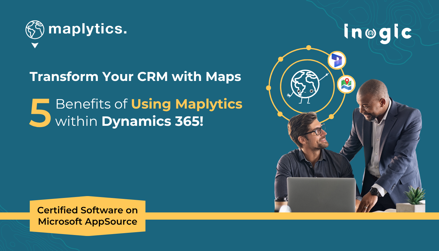
In today’s data-driven business landscape, mapping and location intelligence tools have become essential, not just for visualizing data but for driving smarter decisions, faster action, and optimized resources. Among the many geo-mapping applications available, Maplytics stands out as the most powerful, flexible, and efficient Dynamics 365-native solution available today.
Whether you’re a field sales rep on the go, a territory manager handling multiple regions, or an operations strategist looking for real-time geographic insights along with long-term analytics, Maplytics, the premier certified software on the AppSource, has something for everyone. And with a free trial version available, you can explore its potential without immediate commitment.
Here are five compelling reasons why Maplytics is the best geo-mapping application for your business.
1. Accurate Geocoding That Brings Your CRM Data to Life
The foundation of any good mapping solution begins with accurate geocoding, the process of converting text-based location data, such as an address or zip code, into geographical coordinates that can be plotted on a map.
Maplytics ensures precise and seamless geocoding of your Dynamics 365/ Power Apps/ Dataverse data, whether it’s leads, contacts, accounts, or custom entities. No more guesswork or manual plotting; Maplytics automatically pinpoints each record’s location on the map with high accuracy on Bing/ Azure Maps using custom pushpins. The data also gets categorized as required.
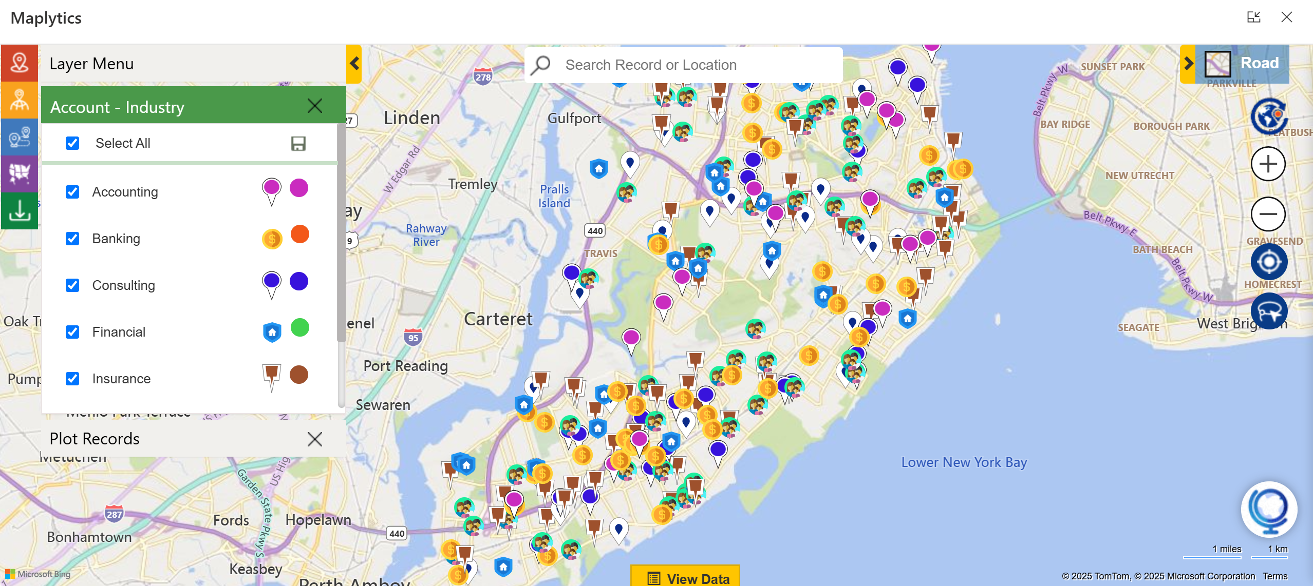
This not only enables better visualization but also powers advanced location-based features like proximity search, route optimization, and heat maps, making your CRM data far more actionable.
2. Mobility Across Devices for Teams on the Go
In the age of hybrid work and mobile-first workflows, mobility is everything. Maplytics ensures that your field teams are never disconnected from insights, no matter where they are.
With native compatibility across desktops, tablets, and mobile devices, Maplytics lets users access location-based data and features while on the move. Field service reps can view appointments, get optimized routes, check traffic conditions, and share meeting notes, all from their smartphones.
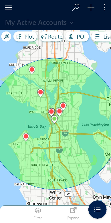
The interface is clean, intuitive, and responsive, ensuring a consistent experience across devices. This mobility empowers field teams with real-time information and allows them to deliver better service, reduce travel time, and maximize daily efficiency.
3. Analytical Dashboards for Smarter Decisions
What’s the use of geo-mapping data if it doesn’t help you make better decisions efficiently?
Maplytics comes equipped with powerful analytical dashboards that make accessing raw CRM data as visual insights quick and easy. Thinking beyond maps, these dashboards offer a comfort to view region-wise performance analysis or high sales regions, service appointment statistics, or anything more relevant in a customized manner.

Users can segment templates to view heat maps, pie charts, column graphs, area sales, client density, etc., right inside Dynamics 365. These insights allow managers and decision-makers to identify trends, track team performance, and adapt or cultivate their strategy based on real-world patterns.
With Maplytics, mapping isn’t just visual—it’s strategic.
4. Effortless Management of Multiple Territories
Territory management is often a complex task, especially when sales, service, and support teams are spread across vast and overlapping regions. Maplytics makes this challenge easy to handle through its advanced territory management module.
Users can create, assign, and visualize multiple territories on the map using postal codes, city boundaries, or drawing tools. Each territory can be linked with specific sales reps or teams, allowing for clear accountability and streamlined reporting.
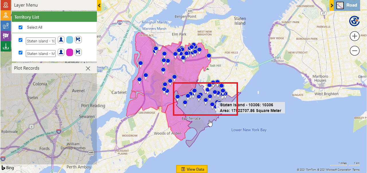
Even better, territory creation can be automated, and performance can be measured at the territory level. Maplytics supports territory realignment, performance tracking, and analytics to help businesses continually optimize resource allocation for a balanced workload.
Whether you’re expanding into new regions or restructuring your team, Maplytics provides a smart and visual way to manage your business footprint.
5. ESRI Map Overlay for Advanced GIS Integration
For organizations that rely on deeper spatial analysis, Maplytics offers ESRI’s ArcGIS Feature Layer overlay support, making it a game-changer for industries like environmental services, utilities, logistics, and urban planning.
With the ESRI integration, users can overlay rich GIS datasets such as zoning maps, flood zones, population data, or utility networks on top of their CRM records. This fusion of enterprise data and public GIS layers provides a more holistic view of operations and risks.
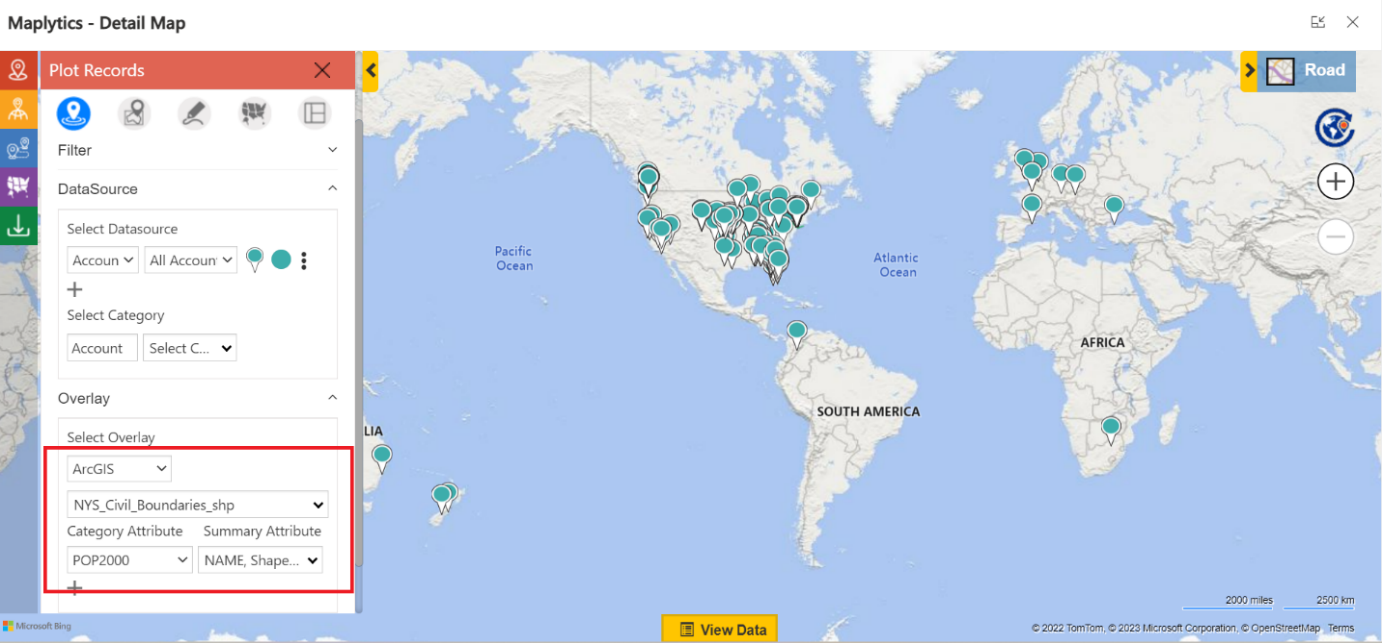
Whether you’re planning site visits, analyzing infrastructure coverage, or understanding demographic trends, the Maplytics + ESRI team-up gives your CRM unmatched spatial intelligence.
From geocoding and mobile support to analytical dashboards and advanced territory management, Maplytics checks every box for businesses looking to harness the power of geo-mapping inside Microsoft Dynamics 365.
Try Maplytics with the Free Version
Do you still don’t feel ready to go all in yet? No problem!
Maplytics offers a 15-day free trial version so you can explore its capabilities first-hand within your Dynamics 365 environment. Get a taste of the certified geo-analytical features and see how it transforms the way your teams operate, analyze, and grow.
What’s More?
Maplytics is like water that can be moulded into any shape. It makes Bing Maps and Azure Maps integration within Dynamics 365 look seamless. Radius Search, Route Mapping, and more have become super easy to use. To gain a deeper understanding and experience it firsthand, you can write to crm@inogic.com. To investigate the product further with a personalized demo within Microsoft Dynamics 365 CRM / Dataverse, get in touch with the team. For applied knowledge, do visit our website or Microsoft AppSource. One can hop onto the detailed Blogs, Client Testimonials, Success Stories, Industry Applications, and Video Library for a quick query resolution. You can check out our technical tutorial video series #KnowYourMaplytics here, and for fun Tips & Tricks about Maplytics, have a look at our series #ProAtMaplytics here. Technical docs for the working of Maplytics are also available for reference.
You can also leave us a review or write about your experience on AppSource or the G2 Website.


