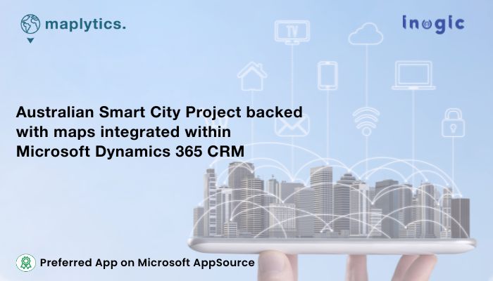
Major cities all over the world have been pushing toward smart city innovations. They’re racing to lead in the future of urban society. Canada, the United States, and Britain are in a close contest for the top spots in the market, and Australia is joining the pack with new Smart Cities Plans initiated both by the Government and private developers.
Planning a Smart City starts with selecting a proper convenient area for it. This is followed by a provision of facilities within the city, considering the distances to the facilities, the integration of the specialties of the nation into the city, and a lot more! Since a majority of the planning tasks are location-based, leveraging location intelligence to plan and build such smart cities is a given. Location intelligence is synonymous with Maplytics. So, can Maplytics be applied? Let’s explore!
Consider Switching of Shawn, to be a hypothetical smart city project in East Australia funded by the Council and the Government of Australia to understand the application of Maplytics correctly. Let’s assume that the major areas of concentration for this project are-
- City Policing and Safety
- Urban Planning and Sustainability
- Cultural and Environmental Inclusivity
The planning starts with Land and Area selection to set up the city. Australia is known for its coasts. The water sports revenue forms a major part of the Aussie Tourism Revenue. Revenue in the Water Sports Equipment market amounts to US$179.30m in 2023. Thus, the inclusion of the coastal culture is profitable. Tourism can also be benefitted from such a smart city and vice versa.
Maplytics’ integration with Azure Maps enables even more precise location intelligence, making land area selection smarter and more responsive to environmental variables like weather patterns, coastal dynamics, and sustainability factors. Additionally, Land Area Mapping could be used to hunt for a proper location that is near the coastal regions while being a part of the residential density.
The city of Gold Coast, with its abundant coastline, and other aquatic adventures would tick the checkbox for tourism, beaches, and water sports for our assumed smart city of Switching of Shawn. The Census Data of that particular land area region could also be mapped with the Microsoft Dynamics 365 CRM Data using Maplytics and the demographics of the people around could be analyzed.
Using the power of these effective features, the city could be planned near the coast that is flocked with tourists and which caters to other aspects of tourism and water sports. This would also help in the aim of sustainability by creating job opportunities for the citizens of our smart city. Culture and Environment would also get included. With demographics mapped and analyzed, the income groups and spending powers of the target groups could be studied for whom the smart city is aimed. The city facilities could be budgeted accordingly.
With smarter Territory Management, as announced in Maplytics’ 2025 release, urban zones can be easily divided into logical, manageable regions based on data such as population density, land usage, and infrastructure availability. This enables efficient public service allocation, targeted policy implementation, and seamless coordination between city departments.
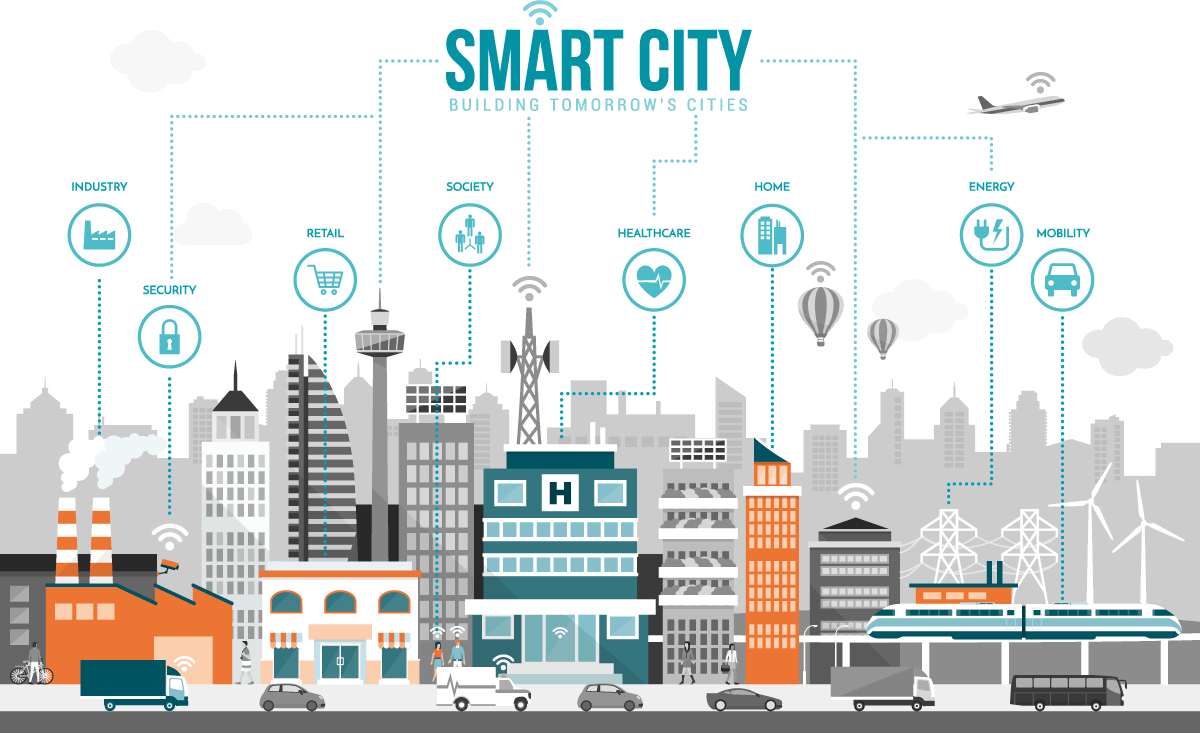
A Smart City becomes smarter with the facilities it provides within the city gates. Educational institutions, Corporate Institutions, Healthcare facilities, recreation and entertainment facilities, and Maintenance and Order are some of the hotspots focused on. Using Maplytics the places dedicated to these facilities in Switching of Shawn could be plotted on the map using the CRM Data. Their distance and proximities could be gauged from the areas of residential complexes using the Proximity Search feature. The travel routes within the city from a restaurant to a corporate wing could be plotted using the optimized routing feature. This would also help in setting up facilities for healthcare at the shortest distance or nearest to schools, residential areas, etc. To stay connected with the regions outside the city, transport facilities could be set up with these effective travel routes with multiple stops determined as per population density within Switching of Shawn. For instance, optimized travel routes could be plotted from Brisbane if the Gold Coast is the city finalized for the Switching of Shawn.
With the new Canvas App enhancements, city planners can now interact with Maplytics features directly within custom Power Apps, making decisions on-the-fly during field visits or planning sessions.
A standout feature allows planners to plot external Excel records directly onto a map without importing into Dynamics 365. This is a game-changer during early brainstorming phases, allowing planners to visualize land use, resource allocation, and third-party data swiftly without overwhelming the CRM.
The inter- and intra-city transport needs to follow a schedule that could be fixed using the Auto Scheduling Feature. The bus/taxi timings and routes, say from Benowa to Gold Coast at 8 am on weekdays, could be determined in advance. To maintain more law and order within the city, CCTV Cameras and sufficient street lighting need to be set up. Maplytics could help within the planning phase in spotting the points on the map with pushpins where the CCTVs and light poles need to be installed. Similar planning could be done for setting up urban facilities such as solar panels, groundwater reservoirs, terrace gardens, waste recycling plants, and so on. Depending on the direction of the rain, water collection areas, and direct sunlight zones, in the city region, the provision could be planned on the map.

During the construction phase of the city, the transport of labor and construction materials to these points could be eased out with optimized routes. Solar Panels could be transported within the shortest time frame from say Lamington to Gold Coast. Heat Maps could be used to analyze the density of crowd movement in various parts of the new city to set up places of recreation, malls, supermarkets, stores, etc. accordingly. Territories could be created on the map to envision areas for residences, gardens, parking, open spaces, touristy things, etc.
To sum up, the concept of Switching of Shawn, Australia could be materialized into an ideal, modern, and sustainable city with immense planning and analysis. Maplytics could be an ideal tool to harness location intelligence for the same. The unique features of Maplytics could be experienced when explored more with a trial. One can write to the Team at crm@inogic.com for mapping requirements, a free trial of 15 days, or a personalized demo within Microsoft Dynamics 365 CRM / Dataverse.
To learn more about Maplytics, its applications across industries, and another multitude of features, do visit the Website or the Microsoft AppSource. For further details, one can hop on to the Blogs, Client Testimonials, Success Stories, Industry Applications, and Video Library for a quick query resolution.
You can check out our technical tutorial video series #KnowYourMaplytics here, and for fun Tips & Tricks about Maplytics, have a look at our series #ProAtMaplytics here. Technical docs for the working of Maplytics are also available for reference.
You can also leave us a review or write about your experience on AppSource or the G2 Website.


