One fine afternoon while scrolling through her Instagram page, Sharon noticed a weird pattern in the ads in her feed. She had been noticing the same for a couple of weeks now. There were pictures and suggestions of cafes and boutiques based in a city about 1000 kilometers from her resident city of Topeka. She was a little overwhelmed and decided to dig in further. Soon with a lot of googling, Sharon remembered the trip she had taken to this neighboring city about a month ago and had searched for a lot of places there. Instagram had probably noted Sharon’s coordinates then and remembered the same for future suggestions! Does that mean Sharon was being stalked? Well, let us see how it works.
Every piece of information in this world has a locational component associated with it. This locational information includes the coordinates of latitude and longitude, distance, time, and other such spatial aspects. Thus, when Sharon was in the new city, her location tracking must have been on to find nearby places. The maps must have saved up this location. The apps used by Sharon, typically all the social media apps have access to this information. Hence, even though, Sharon might not have used Instagram, particularly in the new city, her browser search results, spatial information, pictures clicked and saved to the phone library must have spilled the beans to Instagram. Thus, with this geo-coded information, Instagram must have decided to fill her feed with posts and suggestions from that city and also generated the advertisements from the same region. Geo Analytics is basically utilizing the location-based information of all the data collected and understanding insights to generate further awareness about the collected data.
Geo analytics plays an extremely important role in social media usage, ad suggestions, and in planning marketing strategies utilizing the information thus collected. When a person tags the location of a resort, a shop, or even a shopping mall in his social media posts, the locational coordinates get captured. The place can be viewed easily over maps. The kind of data consumed by this person through their feed or browser searches too gets monitored. These details provide insights about the basic demographics of a person such as age, sex, ethnicity, place of residence, topics of interest, and more. Artificial Intelligence or AI aids in churning out the analyzed and reported information from a plethora of random data collected through the media consumption pattern of an individual. Hence, reading bulk data becomes easier and more efficient.
This analyzed data is extremely accurate and to the point. If a book lover often searches about new novels, discounted novels for sale, book reviews, etc. his social media feed too shall be filled generously with posts and ads related to novels only. If this person swoons over quantum physics, he shall find quantum physics-related book posts in his feed more than some other topics which he does not search much about. If such an avid reader shifts from Liverpool to London, his feeds and ads will boast of book stores in London, book review event suggestions, adverts for book sales, mobile libraries, new book launches, and so on in and around London. With a change in the address comes a noticeable change in the social media feed suggestion, search results, ad displays, etc. If this book reader also happens to visit a particular university every day, for a fixed duration, and search for particular topics on his phone browser, it could be decoded through Geo Analytics that he is a student of ‘X’ University with ‘Y’ subjects. This important piece of information too, is consumed to design his posts and ads.
Since the age group of this book reading student is known, a backpack company could utilize this opportunity for an online survey. If the company is deciding upon introducing student-friendly backpacks and wants opinions of the students consuming it about its design, comfort, price range, and so on, the company could launch a survey with questions as an ad on social media. The possibility of this survey being displayed to our book-loving student is very high as he falls into the desired consumer category. The student upon seeing such a survey could feed in his suggestions as the target audience. Surveys conducted in this manner assure authentic suggestions and requirement information. This process also ensures that as much as possible, a 60 years old retired man is not bothered with questions regarding a college backpack. Any product designed with such first-hand precise information is bound to attract customer satisfaction, popularity, and huge sale.
The precision in information analyzed in this manner can help in post-product launch surveys also. A Cookie Company could take feedback from parents about a specific multigrain chocolate cookie manufactured for young kids using such targeted surveys on social media. Again, the media consumption via phone would help in plotting such parents, with kids in that age group who enjoy such cookies or have been potential customers of the same. If a new variant of a dishwashing soap has failed to make a mark in a particular territory along the west coast, a targeted questionnaire could be circulated to potential consumers living along the coast and investing in dishwashing soaps. This information too could be deduced using their posts, locations, search results, market trips, tags, etc. Similarly, if a variant is seen to be gaining popularity in a particular region, the adverts could be increased or a new marketing strategy could be introduced for the potential TG of that region only to convert the fence-sitter into assured customers. Local discount codes and offers could also be introduced.
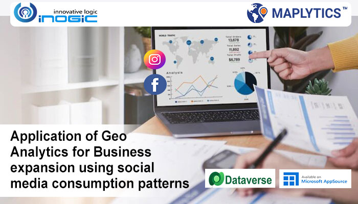
Thus, Geo-analytics plays an extremely important role in determining crucial information from the locational, search, and other data collected through media consumption of the users. Maplytics, a preferred, 5 star rated geo-analytical mapping app on Microsoft Appsource for Microsoft Dynamics 365 CRM/ Dataverse (Power Apps), is one such favorite app for spatial analytics. It determines the locational component of the CRM Records, integrates it with Map, and empowers the users with Geographical Data Visualization. Apart from the plotting of records, Maplytics aids in Optimized Routing, Automated Appointment Planning, Territory Management, Route to a Record, Proximity Search, and more! To explore more about Maplytics do visit our website.
You can even download a 15-day free trial from our website or Microsoft AppSource. For further queries or details, contact us at crm@inogic.com. Stay updated with our regular blogs, stories, videos, etc.


